The Seeley Fire began on the Manti-LaSal National Forest with a lightning strike on June 26 and was reported at about 6 a.m. that day.
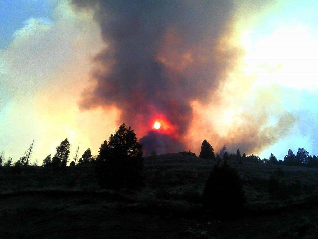
The fire gained intensity as it entered areas containing large components of decadent standing beetle-killed timber, dead and down fuels. Area residents and visitors saw large columns of smoke for several days.
A ridge of high pressure pushed moisture across Utah and the Seeley Fire on Thursday. The widespread wetting rain dropped 0.15 to 0.3 inches of rain on the fire.
Fire activity has since slowed, allowing firefighters safer opportunities to use direct attack tactics to construct fireline. As the weather returns to a warmer and drier pattern, fire activity is expected to increase again.
As containment line is achieved, formerly evacuated areas are being repopulated. The community of Hiawatha has been reopened to full-time residents. Scofield has been reopened and road closures are moving closer to the fire area allowing some rural property owners to return to summer cabins or vacation homes. The fire remains 1 1/2 miles south of the historic community of Clear Creek. Road blocks on Miller’s Flat Road have been removed and the public is now allowed to travel the route all the way through to Fairview.
Heat is being held in the top of Vicks Canyon presenting control challenges in combination with the heavy down and dead fuels located in several spots along the fire perimeter.
SR-31, an important local travel route, has been heavily impacted by debris slides from three canyons when about 1/4 inch of rain fell Saturday afternoon. A combination of surface heating and low level moisture will maintain the chance of thunderstorms today and Monday. These slow moving storms have the potential to produce isolated flash flooding and debris flows, along with brief gusty winds and lightning.
This area is summer mule deer range along with elk, goshawk habitat and several blue ribbon fisheries. Whirling disease and spread of whirling disease is of major concern.
В
- Date started:В В Tuesday, 6/26/2012 5:30 a.m.
- Location:В В 15 miles NW of Huntington, Utah
- Cause:В В В Dry Lightning
- Size:В В В 48,397 acres from IR flight, (76 square miles)
- Percent contained:В В 87%
- Projected Spread: North
- Number of personnel:В В 410В national resources
- Equipment:В В В 17 engines from all over the country
- Aircraft:В В В 1 T-1, 2 T-2 and 1 T-3 helicopters
- Hand Crews:В В 10 (20-person each)
- Dozers:В В 1
- Water Tenders:В В 6
- Estimated containment date:В В 7/15/2012
- Cost to date:В В $6,829,602
- Management Strategy:В В Full Suppression
- Injuries to date:В В none
В
Weather Discussion:В В A strong ridge of high pressure continues across the area through the end of this week. This will result in warm and dry conditions with a 20% chance for showers and thunderstorms. These storms still have the potential to produce isolated flash flooding and debris flows, along with brief gusty winds and lightning.
Property threatened: 250 residences, 15 commercial properties, 500 outbuildings, recreation facilities, communication towers, utility lines, gas lines, coal mining facilities.В
В
В
В