Incident Overview:
The Seeley Fire began on the Manti-LaSal National Forest with a lightning strike on June 26 and was reported at about 6 a.m. that day.
Cabins, homes and a historic ranger station were quickly threatened. Evacuations of the Electric Lake area, Scofield, Clear Creek, Hiawatha and two youth camps were implemented. Due to the vicinity of the fire, a major oil and gas field has been shut down.
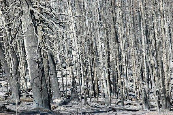
The fire is burning in an area containing large components of decadent standing beetle-killed timber, dead and down fuels and some sage and pinion juniper. The fire is consuming thousand-hour fuels (large dead and down) to white ash, but slows down significantly when it reaches aspen and snowberry fuel components and the scattered fuels on ridgetops. Fire activity has included creeping, single and group tree torching with short upslope crown runs and spotting up to a half a mile.
Significant challenges to suppressing the fire are being presented with single-digit humidities at high elevations, high temperatures and variable winds.
This area is summer mule deer range along with elk, goshawk habitat and several blue ribbon fisheries. Whirling disease and spread of whirling disease is of major concern.
Basic Information:
|
Incident Type |
Wildfire |
|
Cause |
Lightning |
|
Date of Origin |
Tuesday June 26th, 2012 approx. 05:30 AM |
|
Location |
15 miles NW of Huntington, UT |
|
Incident Commander |
John Philbin, E.arizona |
Current Situation
|
Total Personnel |
641 |
|
Size |
38,175 acres |
|
Percent Contained |
15% |
|
Fuels Involved |
10 Timber (litter and understory), Timber, downed and dead fuels, beetle-killed timber, some sage and Pinon/Juniper. |
|
Fire Behavior |
Active. Creeping, single and group tree torching, with short upslope runs and short range spotting. Very aggressive backing fire was observed. |
|
Significant Events |
Burn out operation in Division X, Structure Group, Division B and C continued to prep buildings. Constructed some dozerline as needed in Division C. |
Outlook
|
Planned Actions |
Division A/B Continue providing protection of mine in Section 24, scout and construct potential control lines to hold fire edge in Section 24 Division C Prep control lines for burn out, Implement firing operations as conditions allow. Division Y/Z hold and mop up fire perimeter in left fork canyon, Utilize T-2 Helicopters to support crews. Division W/X continue prep and burn out of control lines. Hold and mop up burnout from previous shift. Continue to provide structure protection plan for Hiawatha. Structure group continue triage and prepare structure protection plan for Hiawatha and Valentine. Night monitor. |
|
Growth Potential |
High |
|
Terrain Difficulty |
High |
|
Remarks |
Evacuations include the Electric Lake area, Scofield, Clear Creek, Miller Flat Reservoir area, Hog Flat area and two youth camps. Due to the vicinity of the fire, a major oil and gas field has been shut down. Several working coal mines in the area remain undera pre evacuation notice. Land ownership: BLM 1412 acres, Private: 4065 acres, State 322 acres and USFS 27612 acres for a total of 33410. |
Current Weather
|
Wind Conditions |
31 mph W |
|
Temperature |
79 degrees |
|
Humidity |
9% |
В
В
В
В
В