Sunday was the estimated containment date for the Seeley Fire, but the fire continues to smolder and has only reached 98 percent containment. The fire continues to burn in the Vick’s Canyon area.
Basic Information
Incident Type:В Wildfire
Cause :В Lightning
Date of Origin:В Tuesday June 26th, 2012 approx. 05:30 AM
Location:В 15 miles NW of Huntington, UT
Incident Commander:В Rutter/huntsman(t)-type 3
Current Situation:
Total Personnel:В 102
Size:В 48,038 acres
Percent Contained:В 98%
Estimated Containment Date:В Monday July 16th, 2012 approx. 08:00 PM
Fuels Involved:В 10 Timber (litter and understory), Timber, downed and dead fuels, beetle-killed timber, some sage and Pinon/Juniper.
Fire Behavior:В Creeping and smoldering in the aspen and spruce. Minimal isolated tree torching in dead spruce.
Significant Events:В The fire has checked itself along the ridgeline in Vicks Canyon. The moisture the fire received has helped secure firelines.
Outlook:
Planned Actions:В Cold trail last portion of line in Vicks Canyon. Weather permitting, construct line where feasible.
Growth Potential:В Moderate
Terrain Difficulty:В Extreme
Remarks:В 50 acre increase to incident acreage due to continued burn out of fuels on ridgeline between Grange Canyon and Vicks Canyon. A spot fire was suppressed before it was able to establish itself in Grange Canyon. Land ownership: BLM, 2210 acres; Private, 5994 acres; State, 958 acres; State DNR Area, 439 acres; and USFS, 38437 acres for a total of 48,038 acres.
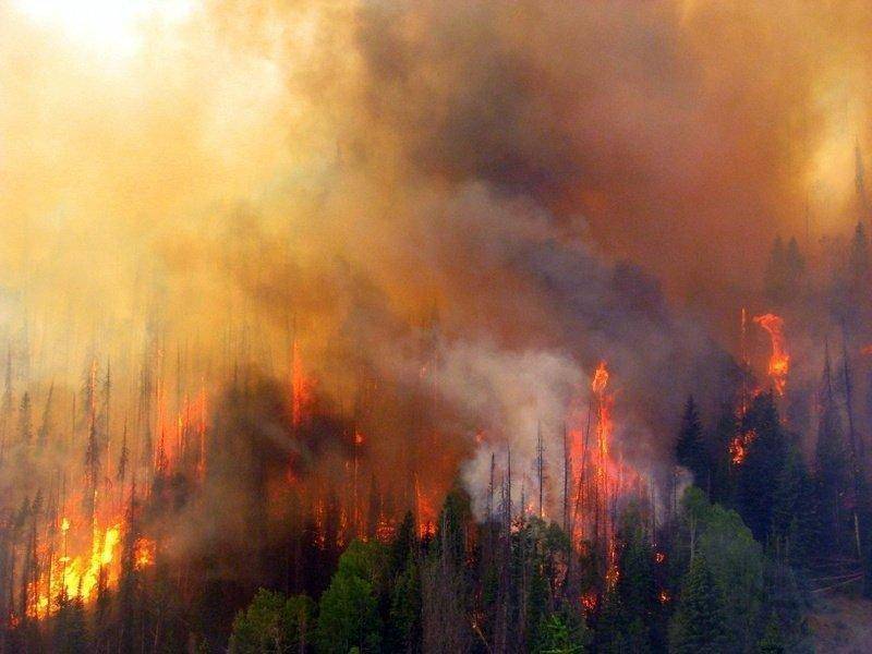
The Seeley Fire began on the Manti-LaSal National Forest with a lightning strike on June 26 and was reported at about 6 a.m. that day.
The fire gained intensity as it entered areas containing large components of decadent standing beetle-killed timber, dead and down fuels. Area residents and visitors saw large columns of smoke for several days.
A ridge of high pressure pushed moisture across Utah and the Seeley Fire on Thursday. The widespread wetting rain dropped 0.15 to 0.3 inches of rain on the fire.
Fire activity has since slowed, allowing firefighters safer opportunities to use direct attack tactics to construct fireline. As the weather returns to a warmer and drier pattern, fire activity is expected to increase again.
As containment line is achieved, formerly evacuated areas are being repopulated. The community of Hiawatha has been reopened to full-time residents. Scofield has been reopened and road closures are moving closer to the fire area allowing some rural property owners to return to summer cabins or vacation homes. The fire remains 1 1/2 miles south of the historic community of Clear Creek. Road blocks on Miller’s Flat Road have been removed and the public is now allowed to travel the route all the way through to Fairview.
Heat is being held in the top of Vicks Canyon presenting control challenges in combination with the heavy down and dead fuels located in several spots along the fire perimeter.
SR-31, an important local travel route, has been heavily impacted by debris slides from three canyons when about 1/4 inch of rain fell Saturday afternoon. A combination of surface heating and low level moisture will maintain the chance of thunderstorms today and Monday. These slow moving storms have the potential to produce isolated flash flooding and debris flows, along with brief gusty winds and lightning.
This area is summer mule deer range along with elk, goshawk habitat and several blue ribbon fisheries. Whirling disease and spread of whirling disease is of major concern.