Press Release
Some clouds are beginning to enter the area, increasing a chance for thunderstorms through Monday. Temperatures will remain in the low 90s and relative humidity will linger in the teens. The biggest concern to firefighters will be gusty outflow winds from passing thunderstorms, particularly if they pass directly over the fire area. Check evacuation and closure areas before recreating or visiting the fire area as fire conditions can change rapidly. The winds are likely to lessen the severity of the smoke inversions and improve air quality.
Yesterday afternoon, a drone was spotted flying near Strawberry Reservoir where aircraft were scooping water for the Coal Hollow Fire. While it was outside of the restricted flight area, it is still unsafe to operate drones near other aircraft. This could result in collisions or in the suspension of aviation operations for the safety of our aerial firefighting personnel, which compromises the safety of the ground firefighters as well.
COAL HOLLOW FIRE – https://inciweb.nwcg.gov/
Location: 15 miles southeast of Spanish Fork, Utah
| Start Date | Cause | Size | Containment | Crews | Engines | Helicopters | Total Personnel |
| 8/4 | Lightning | 19,360 acres | 0% | 5 | 16 | 3 | 304 |
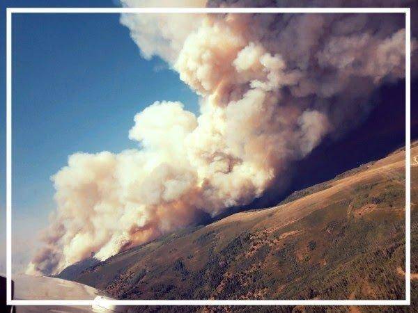
Current Situation: The Coal Hollow Fire continues to burn actively around all portions of the fire perimeter. Firefighters are constantly monitoring its progress, either from lookout points or from the air. Additional resources were added to the night shift to keep a continuous presence on the fireline.
In the northwest corner, the fire is moving laterally down canyon (west). Because the terrain is difficult, firefighters are taking an indirect approach and burning out from US 6 to reduce the available fuels for the fire as it moves downhill. In the Right Fork of Clear Creek, the fire is advancing towards US 6 as well.
Total acreage on the fire has been broken down into approximate values by agency ownership: West Desert District Bureau of Land Management, 366 acres (2%); private, 277 acres (2%); Utah Department of Natural Resources, 2,900 acres (16%); and Manti-La Sal National Forest, 14,000 (80%).
Tomorrow, a new Incident Management Team (IMT) will replace Great Basin Team 4, which will return to their homes after having already spent two weeks on fires in the west. The Rocky Mountain Type 1 IMT will remain at the same fire camp and assume the operations and command of the Coal Hollow Fire.
Evacuation and pre-evacuation notices remain unchanged; however, Utah, Carbon, and Sanpete County Sheriffs are continually assessing these lines. Please visit https://www.ready.gov/ for tips on preparing for evacuations. Knowing where you will go and what to take with you is critical to a safe and speedy evacuation.
HILL TOP FIRE – https://inciweb.nwcg.gov/
Location: 6 airmiles north of Fairview, Utah
| Start Date | Cause | Size | Containment | Crews | Engines | Helicopters | Total Personnel |
| 8/6 | Human | 1,861 acres | 80% | 1 | 18 | 0 | 100 |
Current Situation: Great Basin Team 4 will remain in command of the Hill Top Fire through tomorrow. The fire is nearing full containment. Firefighters are working to mop up hot spots near the fire perimeter and are monitoring fire activity in interior cottonwood stands. Today, firefighters will concentrate their efforts on the southernmost portion of the fire, where the last remaining uncontained fireline is. Some rehabilitation work will also begin, such as repairing dozer lines. Large machinery known as masticators are removing cottonwood snags for the safety of the firefighters still working in the area as well as for the general public once the area opens.

