Press Release
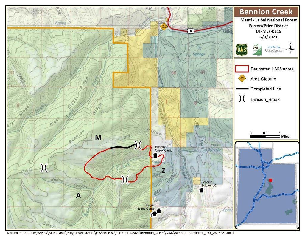
Manti-La Sal National Forest fire officials are currently engaged in wildfire activities southwest of Soldier’s Summit. The Bennion Creek Fire, reported Friday, June 4, is at 1,371 acres burned along the Bennion Creek drainage area.
“Tuesday’s moderate growth of fire was due to drought conditions and low fuel moistures on the Forest,” said Matthew Way, incident commander for the fire. “There has been a lot of smoke visible from multiple counties today, and which is due to the fire, aligned with ground slope and high winds, making uphill runs through Conifer stands.”
The fire is burning on rugged, steep terrain, through a mix of Sagebrush, Juniper, Pinyon Pine and mixed Conifer. Continued red flag conditions have created challenges for fire crews, but containment is currently at 10 percent.
“Fire personnel are securing bulldozer lines along Bennion Creek Ridge, checking handlines established Monday around private property and a youth church camp, as well as scouting west of the fire activity to identify future locations for handlines,” Way said.
Firefighters were successful in suppression efforts, containing the fire outside the private property and youth camp, preventing property damage.
Approximately 150 personnel are on site, including three interagency hotshot crews, two Type 2 IA Crews, six engines, two dozers and five helicopters. Responders include state agency partners, Bureau of Land Management resources, municipal cooperates and U.S. Forest Service personnel from Utah, Idaho, Montana and Nevada.
“Our resources are doing a great job considering the steep terrain and dry fuel conditions we are experiencing,” Way said. “Air resources being utilized on the incident have been a great asset for our ground resources, allowing us to maximize containment efforts.”
Road closures include Bennion Ridge Road and Starvation Road. Smoke is periodically visible from surrounding communities and Highway 6. Hazy road conditions may occur on the highway and drivers are encouraged to slow down and use caution when vision is impacted.
For public and firefighter safety, the public is asked to avoid the impacted areas. Several spike camps have been established in the general fire area to allow firefighters a spot to decompress.
There are currently no fire restrictions on the national forest, but conditions remain extremely dry. As a reminder, practice appropriate fire safety measures. Do not allow fires to grow tall and do not leave fires unattended. If it’s too hot to touch, it’s too hot to leave. Current high wind conditions can carry embers from a large, unmanaged campfire, giving way to additional wildfires.
-
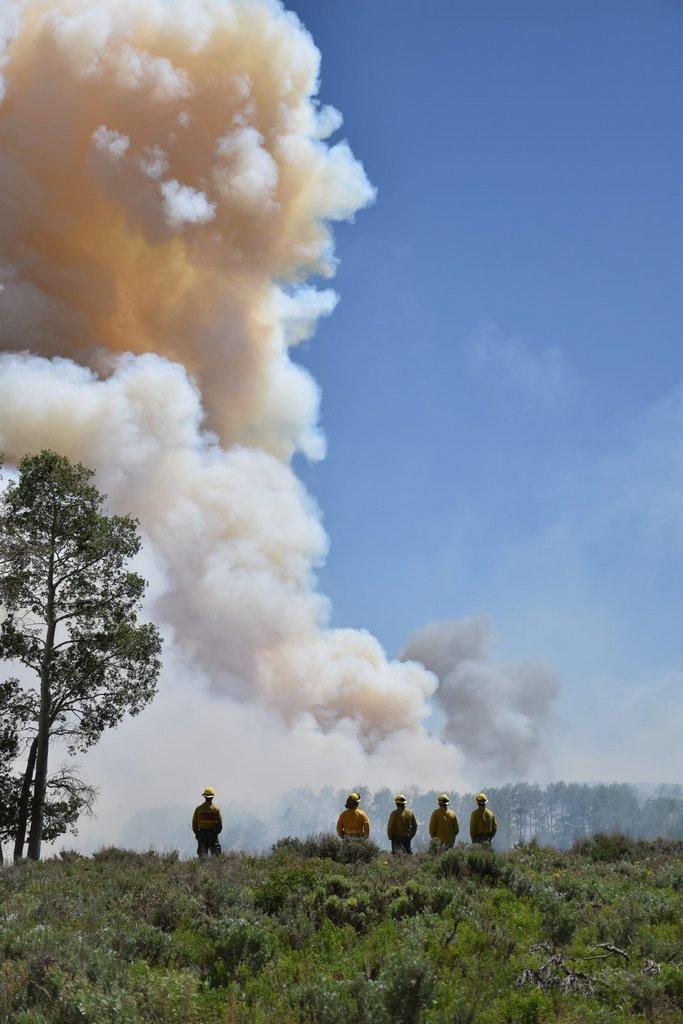
- Firefighters with Idaho Engine monitor fire burning in mixed conifer at the Bennion Creek fire June 8. The Bennion Creek Fire, reported Friday, June 4, is at 1,371 acres burned along the Bennion Creek drainage area. (U.S. Forest Service photo by Samantha Stoffregen)
-
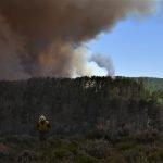
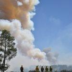
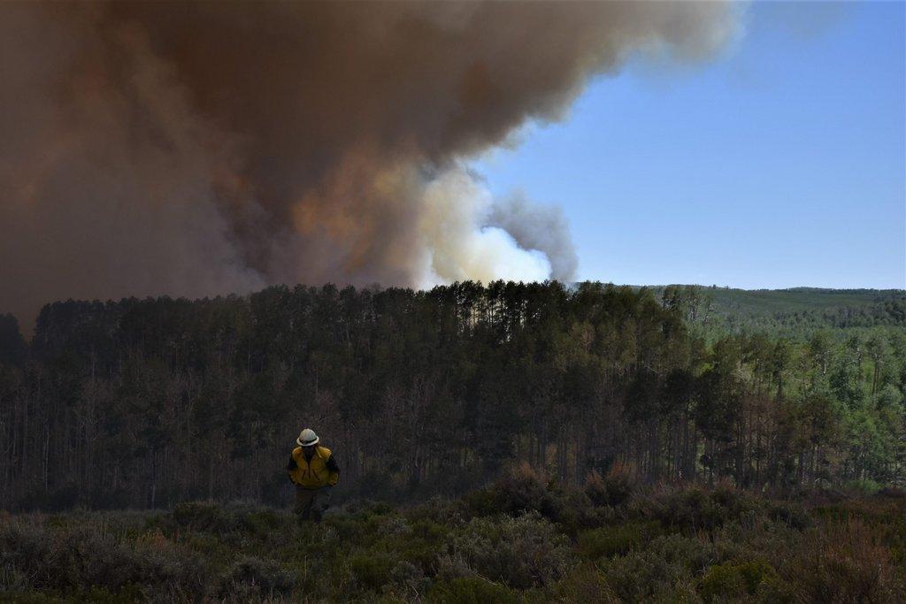
- Firefighter scouting future fireline to the northwest of the Bennion Creek Fire on June 8. (U.S. Forest Service photo by Samantha Stoffregen)
-
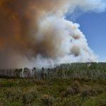
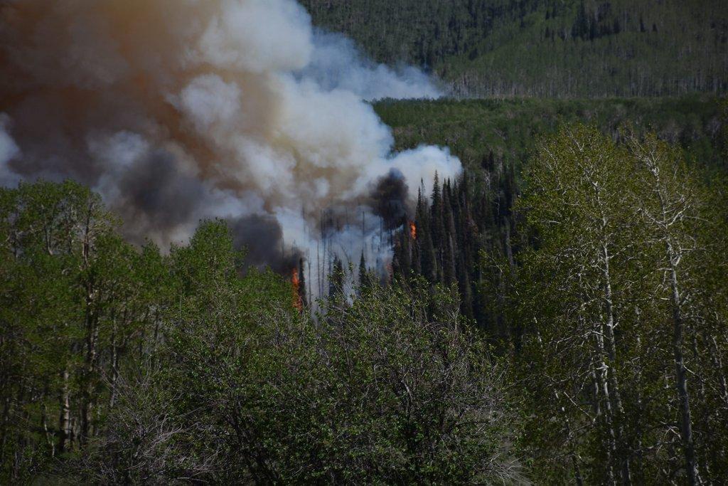
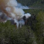
- The Bennion Creek Fire making an uphill run through mixed conifer on June 8. (U.S. Forest Service photo by Colin Dunn)
-
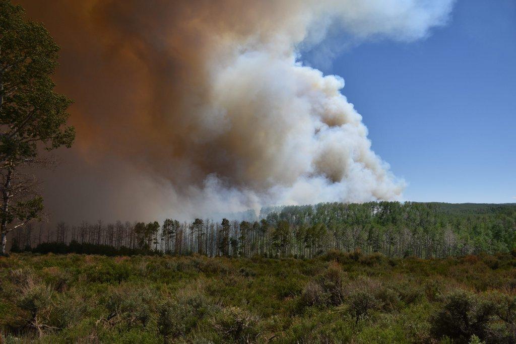
- The Bennion Fire burning through a mixed conifer stand bordered by Quaking Aspen on June 8. (U.S. Forest Service photo by Colin Dunn)