
Photo by Tyson Chappell
By Ray Petersen
Why would Emery County give up the ability to build new roads in the proposed Recreation Area?
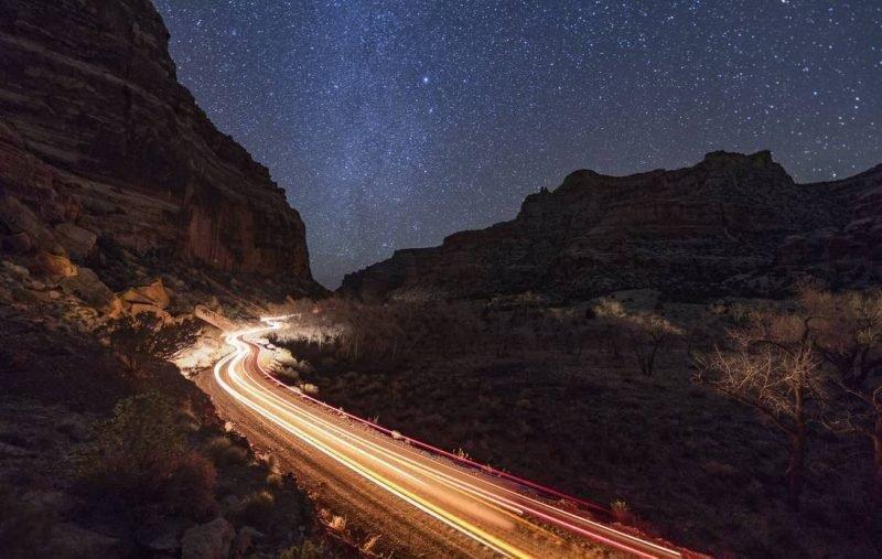
To answer this question, it will be helpful to understand the history of road building and road use in the San Rafael Swell. The earliest “roads” would have basically been trails, which were initially traversed by horse, mule or foot. These routes were necessarily located in the path of least resistance. That’s why historic routes such as those in Buckhorn Draw, Cold Wash, Temple Wash, Cain Wash, Black Dragon and others are where they are. Accounts of the earliest non-native visitors are colorful indeed and are a part of the “western heritage” component of S 2908. Continuous use of those routes in motorized vehicles established the first “user created” routes. The livestock industry created the purpose and need for these earliest routes.
At given periods in time, uranium, oil, tar sands and even copper were minerals that fueled exploration into the Swell and surrounding areas and represent “historic mining” element of the bill. Motorized road building equipment allowed better and better roads to be established as these resources were pursued. Airstrips were also constructed as light aircraft allowed faster access to areas than overland travel. The livestock folks benefitted from the improved roads as well.
These early, constructed roads were mostly to serve those needing to reach a particular destination in the Swell. There was no real fast and efficient route to pass through this rugged country, even though federal policy at the time allowed for the construction of roads for the purpose of the public. In the late 50s, as the federal highway system began to be implemented in the west, planning and construction of Interstate 70 began. This ambitious highway project eventually bisected the Swell and made the wonder of the area available to far more people than had been exposed to it up until that time.
Ideas and proposals for various types of designations soon were being talked about. National Park status had support from many. The Wilderness Act of 1964 introduced another possibility for designation. Nearby Capitol Reef was designated a National Monument, and later a National Park.
Many new visitors to the Swell began enjoying the location for the visual and open space resources. Today, livestock grazing continues as an important component of the agricultural industry, but minerals exploration and development is quite marginal. As motorized vehicles and recreation has evolved, the roads pushed into the Swell for mineral exploration became favorite routes for motorcycles, 3 and 4 wheelers, side-by-sides and full sized vehicles. Two different Bureau of Land Management plans, in 2003 and 2008, have evaluated the routes and designated some as “open” routes and also chose to close many.
The designated routes from the 2003 and 2008 management plans, plus Emery County “B” Roads and BLM system roads, make up the roads and trails that are open and in use in the proposed Recreation Area and Wilderness Areas. Through all of the political drama and collaboration in getting this legislation to this stage, the Emery County Public Lands Council and Commissioners have delivered on the promise to protect motorized routes, which were analyzed and designated by BLM fifteen years ago and are currently open.
So, why would Emery County forfeit the right to construct new roads in the Recreation Area? To begin to answer that question, let’s ask another: when is the last time Emery County built a new road in this area? Would you believe 1989, nearly 30 years ago? And technically, what was constructed was a realignment of an existing road and replacement of an existing bridge! It’s quite likely that the same project would be acceptable within the “necessary maintenance or repairs to existing roads” criteria in the bill. The point being, there is not a great need to build new roads. Those that are on the ground now and have been for decades serve the purpose for reasonable access in the Recreation Area. That is why EC has been receptive to the “no new roads” language of HR 5727/S 2908. The existing network has proven to meet the needs for access.
Its interesting to see the numbers associated with the roads and trails being discussed:
Emery County “B” Roads: 213.6 miles
BLM System Roads: 57.46
Designated Routes (motorized trails): 452.5
Single Track (motorcycle): 48.29
Total: 771.85 approx.
Keep in mind also that the “no new roads” position only applies to the land designated in this legislation. Creation of new roads and motorized trails will remain acceptable in the remainder of the county. As a matter of fact, the County Trails Committee is in the early phase of creating a new trail between Millsite and Muddy Creek.
It’s the position of Emery County that the existing roads and trails “provide for the protection, conservation, and enhancement of the recreational, cultural, natural, scenic, wildlife, ecological, historical and educational resources of the Recreation Area.”