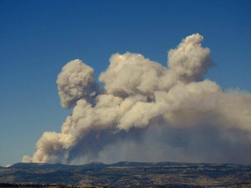
Photo courtesy of the Emery County Sheriff’s Office.
Start Date: June 4, 2018
Size: 16,837
Percent Contained: 59%
Helicopters: 6
Engines: 17
Crews: 8
Total Personnel: 415
Summary: A Red Flag Warning for critical fire weather with high temperatures, low relative humidity, and atmospheric instability was in effect yesterday and continues today. These conditions pushed the fire down Crandall Canyon and kept it active in Little Bear Canyon to the south.
– The fire did not affect the mine and memorial and did not cross Highway 31.
– It burned across slopes north of the mine but did not burn through thick aspen stands south of the mine.
– Firefighters worked late into the night in Crandall Canyon and along Highway 31.
– Pumps and sprinklers ran continuously near the mine and memorial.
– Late last night, firefighters burned above the Crandall Canyon road and below previously constructed fireline on a ridgeline above the road. The purpose of this burning was to reduce vegetation near the mouth of the canyon to limit spread of the main fire.
Today, firefighters will take actions near Crandall Canyon and along Highway 31 based on weather, terrain, and fire behavior to continue protecting the mine. Helicopters will be available to support the work of hand crews and fire engines. Their objective is to keep the fire west of Huntington Canyon Road, Highway 31.
There was no movement of the fire in other areas, and the fire has been contained along most of the southern, eastern and western boundaries. With Red Flag conditions expected today and Saturday, crews will monitor and patrol the entire fire perimeter. In many areas they will continue rehabilitation to reduce the after-effects of suppression work.
Closures: If you’re planning to recreate in the vicinity this weekend, please be mindful that wildland fires are constantly changing environments. Check fire conditions and closure areas via links below before heading out.
The Manti-La Sal National Forest has an area closure in effect around the fire. See a map and description of the area at: https://inciweb.nwcg.gov/incident/maps/5830. Horse Canyon Trailhead, Indian Creek Campground, Little Bear Campground, Lower Little Bear Campground, and Riverside Campsite are closed. Highway 31 is open, but please drive with caution.
For More Information: Visit InciWeb at https://inciweb.nwcg.gov/incident/5830/ and Utah Fire Info at https://utahfireinfobox.com/. You can also follow Utah Fire Info on Twitter, https://twitter.com/UtahWildfire, and Facebook, https://www.facebook.com/UtahWildfire/.

